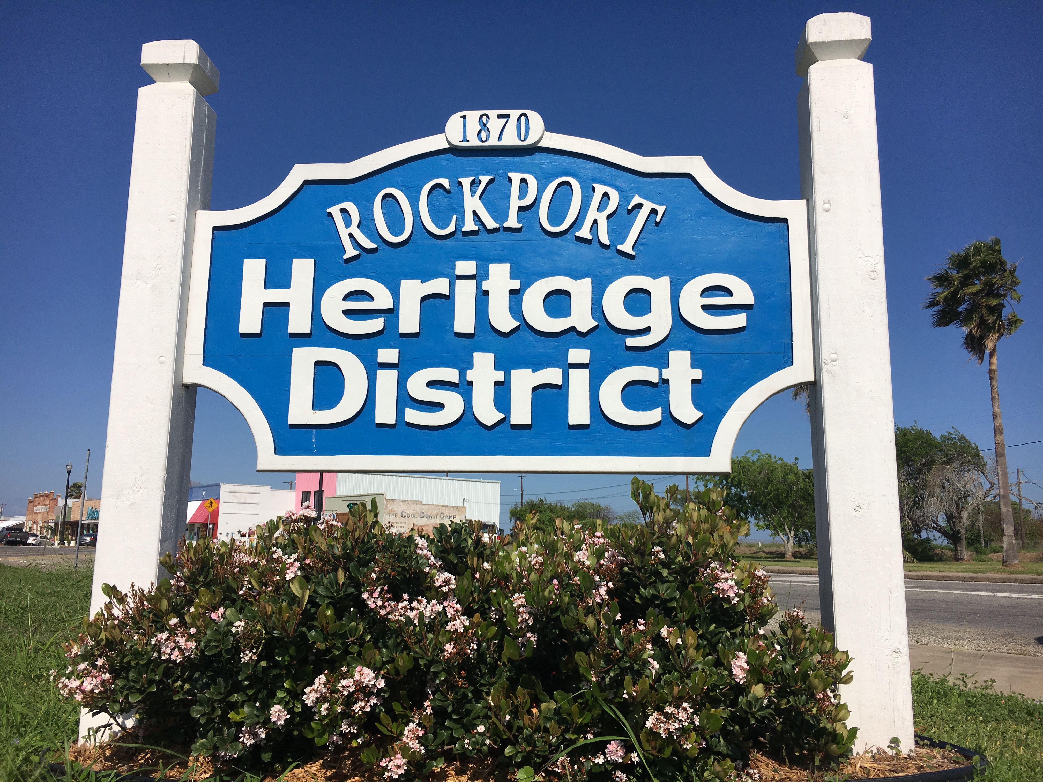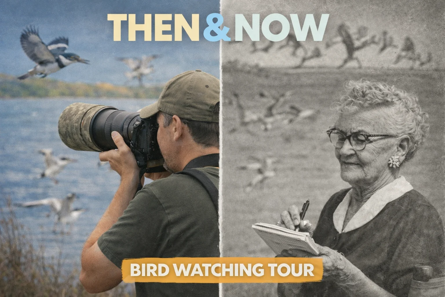
Then & Now Classic Birding Route
The 1989 Connie Hagar driving circuit — revisited 37 years later
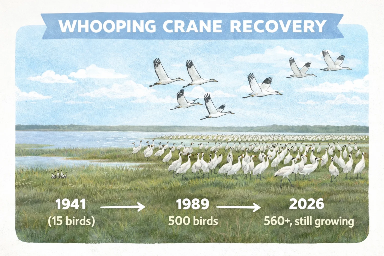
In 1989, the Rockport/Fulton Area Chamber of Commerce published a birder's guide built on the legacy of Connie Hagar — the woman who put this coast on the world birding map. The guide described a driving loop through marsh, bay, woodland, and beach that visitors could begin anywhere and follow for a full day of birding. This tour recreates that exact route in 2026. Some stops are unchanged. Some have new names. Some are gone entirely — replaced by gated communities, residential streets, and roads that no longer exist. The Whooping Crane flock that numbered fewer than 60 birds in Hagar's time has recovered to 560+. The salt marshes that once lined the causeway are million-dollar real estate. Part 1 covers the Lamar Peninsula and the FM 1781 corridor. The birding here is as good as the 1989 guide promised — but the shoreline along Copano Bay holds a deeper story the guide never mentioned. Looking across the water from Rattlesnake Point, you are looking at Live Oak Point: the site of Fort Aranzazu, Spain's 1766 coastal military outpost and the region's first customs house for Spanish Texas. James Power incorporated Aransas City on this shoreline in 1839 — the Republic of Texas's westernmost port before Corpus Christi existed. It was gone by 1847. Across the bay lies El Copano, the deepest natural harbor on the Texas coast, port of entry for Irish immigrants from County Wexford, and the stage for the 'Horse Marines' — mounted Texas rangers who captured three Mexican supply schooners from horseback in June 1836. Part 2 completes the loop through the Rockport/Fulton birding circuit back to Connie Hagar's sanctuary.
★ Tour Highlights
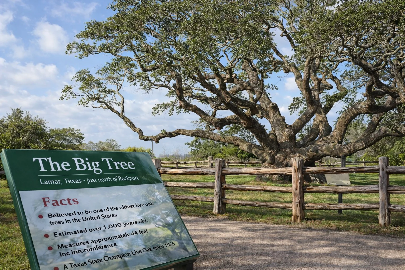
- ✓The Big Tree — 1,000+ year old live oak, the same landmark birders sought in 1989
- ✓No Man's Land — the 1989 guide's prime Whooping Crane marsh is now The Reserve, a gated community
- ✓FM 1781 corridor — the heart of the 1989 route, largely intact for birding
- ✓Fort Aranzazu — Spain's 1785 customs house and the lost port of Aransas City, visible across Copano Bay
- ✓El Copano — the deepest natural harbor on the Texas coast; port of entry for Irish immigrants from County Wexford
- ✓The Horse Marines — Texas rangers who captured three Mexican supply schooners from horseback in June 1836
- ✓Connie Hagar Cottage Sanctuary — where the loop ends, and her legacy began
- ✓Whooping Crane recovery — from 68 birds in 1938 to 560+ today
Ready to hit the road?
All stops pre-loaded in Google Maps.
Tour Stops
The Big Tree
Birding Site1622 12th St, Rockport, TX 78382
Then (1989): The guide approaches from the north on Texas 35, calling out the Big Tree and surrounding habitat as the first landmark — exactly as visitors from Houston still arrive today. Then as now, the live oaks along Lamar Beach Road held migrant warblers in spring and wintering sparrows. Driving south, St. Charles Bay opens to your left. Across the water: Black Jack Peninsula. Now: The 1,000-year-old tree still stands. State Champion Live Oak since 1969.
Alligator Pond
Point of Interest202 Lamar Beach Rd, Rockport, TX 78382
Then (1989): The guide describes this stretch of Lamar Beach Road along St. Charles Bay as prime habitat — open salt marsh with shorebirds and wading birds. With a scope, Whooping Cranes could sometimes be spotted across Black Jack Peninsula. The flounder fishing along the shoreline was exceptional. Now: The alligator pond is a reliable stop year-round. The flounder shoreline access is mostly gone — development has taken the bank. The cranes still winter across the bay.
Goose Island State Park
Birding Site202 S Palmetto St, Rockport, TX 78382
Then (1989): The guide lists Goose Island State Recreational Area as the primary recommended site in the region — 307 acres at the junction of Aransas, Copano, and St. Charles Bays. Address then: Star Route 1, Box 105, Rockport TX. Phone: (512) 729-2858. Now: Entry fee required. The park road has several marsh overlooks — drive slowly. The infrastructure has improved significantly since 1989 but the birds are the same.
Bird Overlook Platforms
Point of InterestGoose Island State Park, 202 S. Palmetto St, Rockport, TX 78382
Then (1989): The guide notes multiple overlook vantages along the park road for scanning open water and marsh. Now: The overlook platforms give elevated views over the interior marsh. Roseate Spoonbills and Great Blue Herons work the shallows below. These views are exactly what the 1989 guide directed birders toward.
Pier over the Marsh
Point of InterestGoose Island State Park, 202 S. Palmetto St, Rockport, TX 78382
Then and Now: The interior marsh pier puts you directly over the shallows — close enough to watch herons stalk and strike. In winter, the marsh holds a reliable mix of wading birds, diving ducks, and occasionally Whooping Cranes if water levels are right.
Fishing Pier — Mouth of St. Charles Bay
Point of InterestGoose Island State Park Fishing Pier, Rockport, TX 78382
Then (1989): The guide described this as the end of the park road — a prime vantage over the mouth of St. Charles Bay toward Black Jack Peninsula. 'With luck and a scope, birders might spot Whooping Cranes across Black Jack Peninsula.' Now: The cranes still use Black Jack in winter. In cold months, White Pelicans gather here in mass — sometimes hundreds at a time on the water. The fishing pier is always active with birds diving and loafing alongside the anglers.
No Man's Land — The Reserve at St. Charles Bay
Point of InterestThe Reserve at St. Charles Bay, Rockport, TX 78382
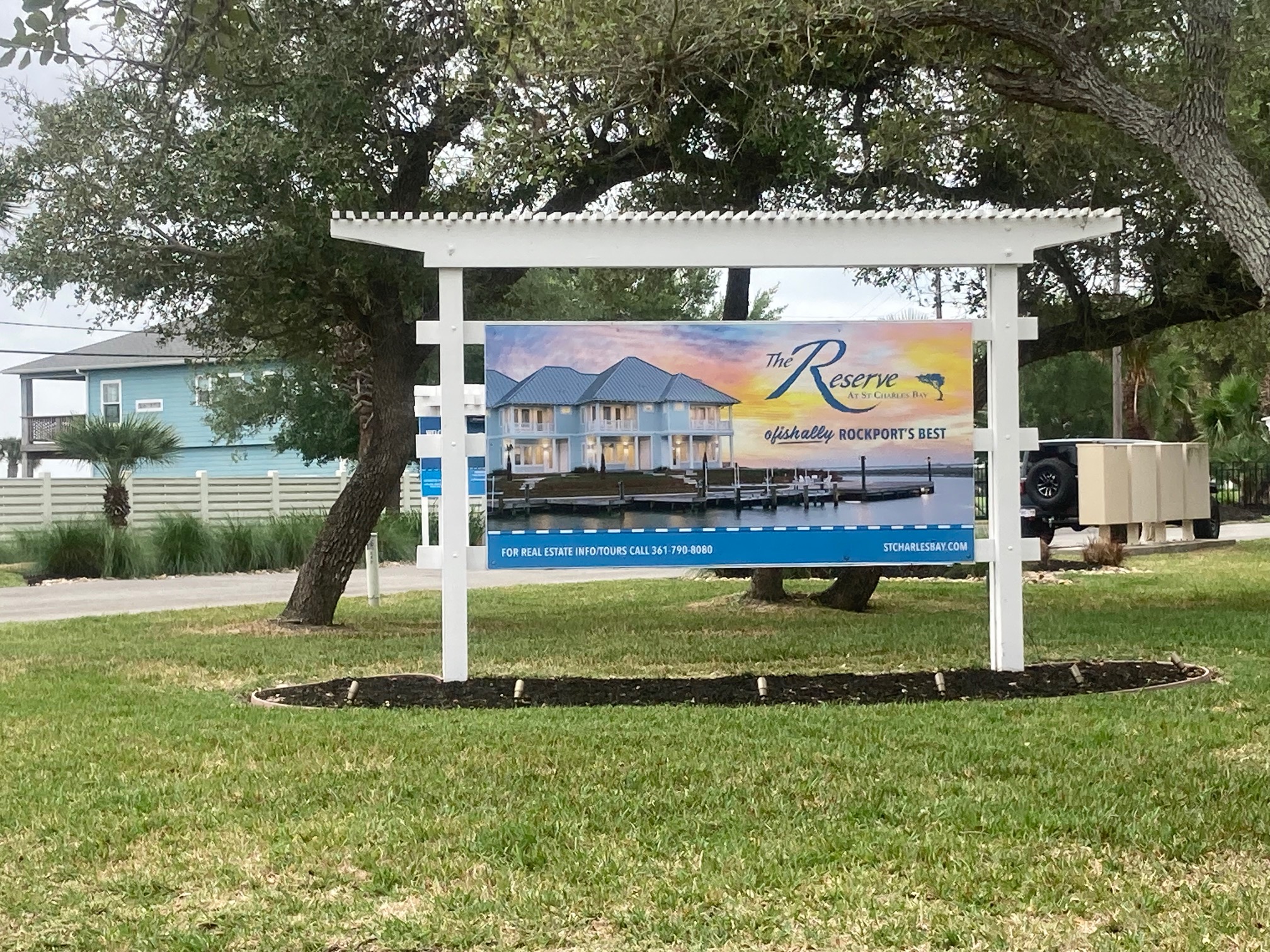
Then (1989): The guide called this stretch 'No Man's Land' — a salt marsh where Whooping Cranes could be spotted across Black Jack Peninsula. The guide warned that marsh roads could be impassable after moderate rain. Flounder fishing along the shoreline was some of the best on the coast. Now: The Reserve at St. Charles Bay. A gated community of million-dollar homes sits on what was open salt marsh. The flounder shoreline is behind a security gate. The marsh roads the guide warned about are private driveways. This is the most dramatic change on the entire 1989 route — 37 years of real estate development compressed into one gated entrance sign.
Copano Causeway South Cabanas
Point of InterestCopano Bay Causeway South, Rockport, TX 78382
Then (1989): The guide directs birders to 'Oystercatcher Point' immediately after crossing the causeway — prime habitat for American Oystercatchers and shorebirds along the rocky causeway riprap. Now: The south causeway cabanas offer a sheltered overlook of Copano Bay. In winter, White Pelicans use this area heavily. The oystercatchers are still here — check the riprap along the causeway base.
Howard Murph Memorial Park
Birding Site4701 Loop 1781, Rockport, TX 78382
Then (1989): The guide describes extensive birding along FM 1781 — live oak stands, thickets, marshes, ponds, and mudflats. An unpaved U-shaped road was noted for sparrows and passerines. An oil company pond supported Olivaceous Cormorants — now called Neotropic Cormorants. Now: Howard Murph Memorial Park at 4701 Loop 1781. Named for Howard Murph, longtime Rockport city leader. The cabana overlook and the surrounding live oak corridor preserve the FM 1781 birding the guide described.
Airport Road
Birding Site1240 Airport Road, Rockport, TX 78382
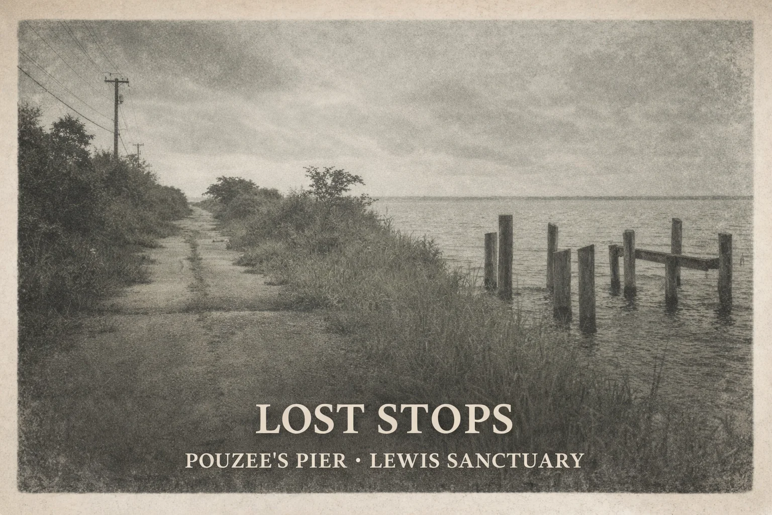
Then (1989): The guide directs birders along FM 1781 past Old Salt Lake Road and Pouzee's Pier — both noted for shorebirds and marsh birds. Both are now gone. Old Salt Lake Road was still on the original Aransas Pathways site list but was removed due to access issues. Pouzee's Pier no longer exists. Now: Airport Road birding site #31 preserves the FM 1781 birding character — open freshwater with reliable wading birds and migratory shorebirds. This is where the 1989 route and the 2026 route most clearly diverge.
Rattlesnake Point Road
Birding Site900 Rattlesnake Point Rd, Rockport, TX 78382
Then (1989): 'Copano Cove / Rattlesnake Point Road' — the 1970 NOAA chart and the 1989 guide agree on the name. The guide lists this section of FM 1781 as prime shorebird habitat. Moore's Pond (still at 2520 FM 1781, site #16) was noted nearby — it still exists by the same name. Now: The kayak launch at Rattlesnake Point gives you the same view of Copano Bay the 1989 birders had. But this shoreline hides something the 1989 guide didn't mention. Looking across the water toward Live Oak Point, you are looking at the site of Fort Aranzazu — Spain's coastal military outpost established in 1766. It wasn't a stone fort like Goliad or Presidio La Bahía. It was a military outpost on the point that guarded the approaches to El Copano, controlled everything that came into Copano Bay, and stopped smugglers, pirates, and French traders from slipping along the coast. In 1785, Viceroy Bernardo de Gálvez officially opened El Copano as a port of entry for Spanish Texas, formally establishing Fort Aránzazu as the region's first customs house. After Mexican independence in 1821, the fort's military significance faded. Today HEB operates that point as a partner recreational area — no trace of the fortification remains. James Power incorporated Aransas City on January 28, 1839, stretching from Live Oak Point south along this shoreline. Power built his first home here in 1837, added a commissary, and laid out the town after Texas Independence. Aransas City served as the seat of Refugio County and held the Republic of Texas customhouse — the westernmost port in Texas before Corpus Christi was founded. Rival port Lamar lobbied President Mirabeau Lamar to relocate the customhouse. Power protested and lost. Aransas City ceased to exist by 1847. There are no remaining structures, but the History Center for Aransas County holds archaeological findings from the site.
Cape Velero
Birding SiteCape Velero Dr access area, Rockport, TX 78382
Then (1989): 'Cape Velero wetlands' specifically named in the guide — one of the reliable shorebird stops along FM 1781. The Ruth and John Lewis Wildlife Sanctuary gate area was also noted in this section. Now: Cape Velero birding site #20 preserves that wetland access. Shorebirds still use the flats in migration and in winter.
Port Bay Road
Birding Site490 Port Bay Club Rd, Rockport, TX 78382
Then (1989): 'Port Bay Club Road' — the guide notes coastal prairie meeting tidal flats, good for shorebirds and wading birds in any season. Now: Port Bay Road birding site #23 at 490 Port Bay Club Rd. The access and habitat are largely unchanged — one of the stops where 1989 and 2026 look the most similar.
Connie Hagar Cottage Sanctuary
Birding Site1429 S Church St, Rockport, TX 78382
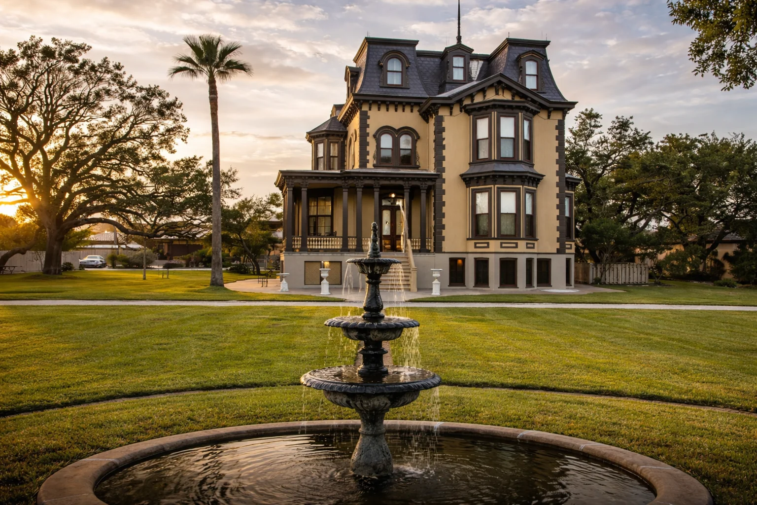
Then (1989): The guide's entire introduction is built around Connie Hagar's legacy. She moved to Rockport in 1935, made daily birding rounds for 35 years, and convinced the skeptical ornithological world that this coast was extraordinary. She died in 1973. The guide, published 16 years after her death, still frames everything through what she discovered. Now: 1429 S. Church St — the sanctuary named in her honor. 6.25 acres of oak motte and native grasses. In spring migration, every oak can be dripping with warblers. The loop ends here, where it always did.
Rockport Beach Park
Birding Site319 Broadway St, Rockport, TX 78382
Then (1989): 'Rockport Beach' noted in the guide as a shorebird and colonial waterbird area — the beach and bay access made it reliable in any season. Now: Entry fee required. Drive all the way to the back of the park to reach Bird Island and the protected nesting colony — Reddish Egrets, Black Skimmers, and Tricolored Herons. Don't stop at the front beach.
Fulton Seawall
Point of InterestFulton Beach Rd, Fulton, TX 78358
Then (1989): 'Fulton Beach' noted in the guide as part of the loop's return — consistent shoreline access for Brown Pelicans, gulls, terns, and in winter, diving ducks just offshore. Now: The seawall along Fulton Beach Road offers the same reliable views. Scan the water from the pulloffs — Common Loon and American White Pelican are regular in winter.
Fulton Beach Road Ponds
Point of InterestFulton Beach Rd, Fulton, TX 78358
Then (1989): The guide completes the loop here — freshwater ponds along the road noted for ducks and wading birds, then back north toward the Big Tree to begin again. Now: The Fulton Beach Road ponds are still productive after rains and in winter. This is where the 1989 loop closed. So does ours.
Historical Glimpses
 View full
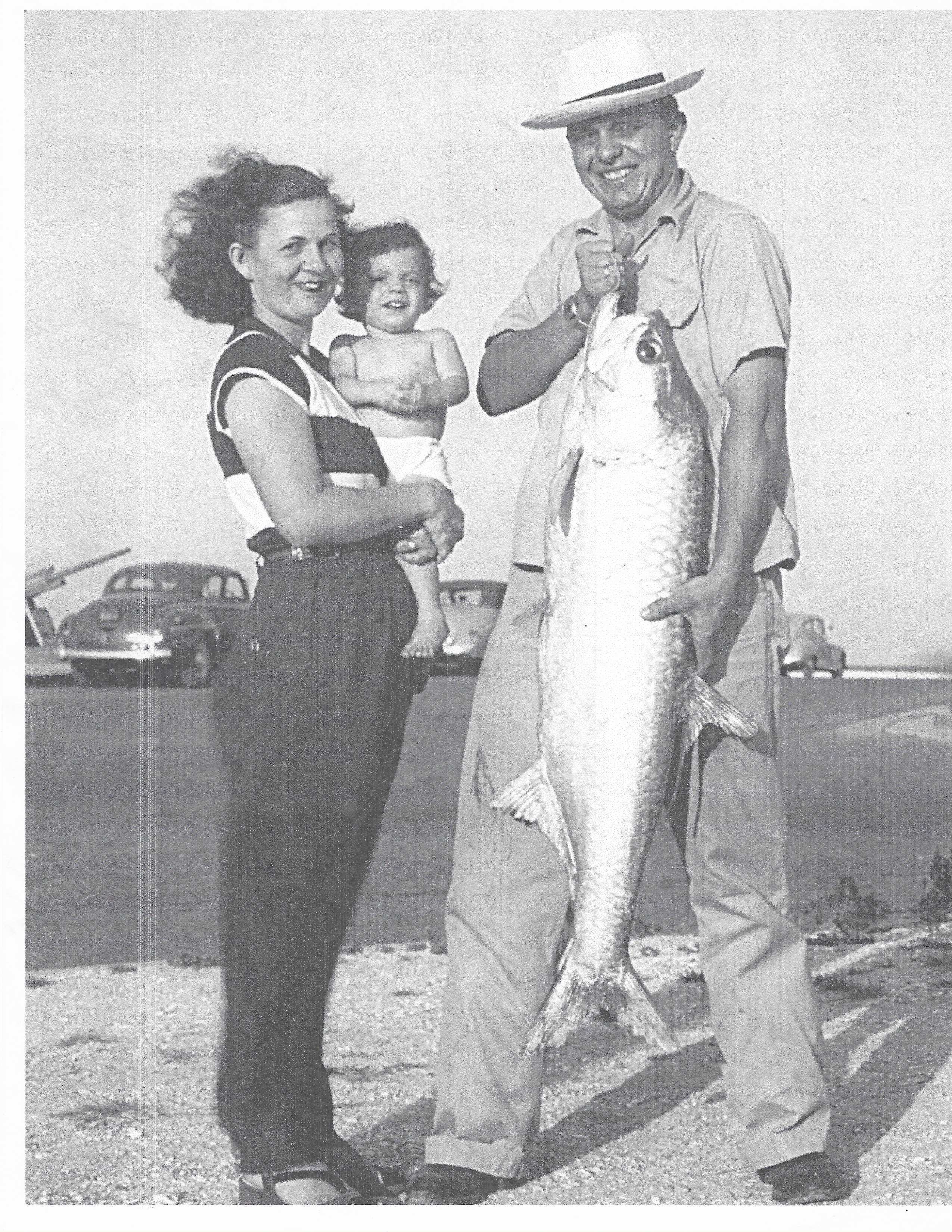
Pat and Frances Williams at Goose Island State Park, approximately 1952. Pat covered two sides of the cabana with tarps and mosquito nets; Frances planned every meal. They fished offshore each summer for a week — the same park, the same bay, 37 years before this guide was written.
 View full
Whooping Crane recovery timeline. When Connie Hagar arrived in Rockport in 1935, fewer than 30 birds survived. The 1989 guide reported 'up to 500 on record' — an optimistic estimate. The flock that winters at Aransas today numbers 560+, part of a total wild population of 830+.
 View full
The Reserve at St. Charles Bay — gated entrance, 2026. The 1989 guide called this stretch 'No Man's Land,' a salt marsh where Whooping Cranes could be spotted across Black Jack Peninsula with a scope. The flounder fishing along the shoreline was some of the best on the coast.
 View full
Lost stops from the 1989 route — Old Salt Lake Road, Pouzee's Pier, several marsh roads along FM 1781 now impassable or private. The guide warned that 'some marsh roads may be impassable after moderate rain.' Most are simply gone.
 View full
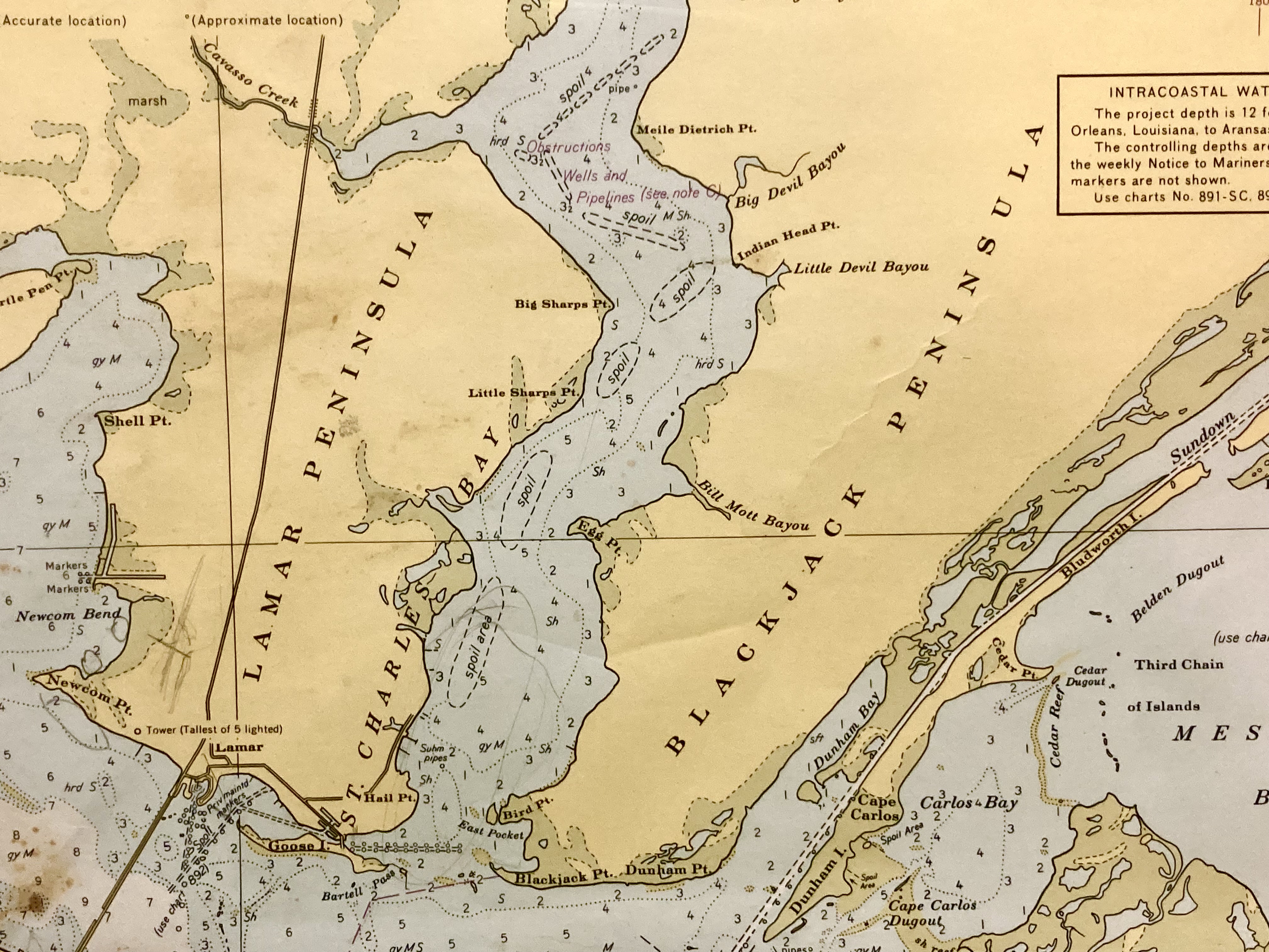
Black Jack Peninsula, 1970 — published by the U.S. Department of Commerce, Environmental Science Services Administration, Coast & Geodetic Survey. Mercator projection, scale 1:80,000, Matagorda Light to Aransas Pass. The 'Oystercatcher Point' the 1989 guide describes appears here as Rattlesnake Point — the name locals always used.
 View full
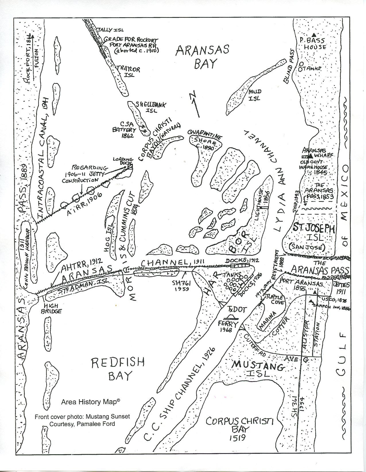
Hand-drawn historical map recreated from local historian Pam Stranaha's original — showing the Lamar Peninsula, St. Charles Bay, and the settlements that shaped this coastline: Lamar, Aransas City, El Copano, and Live Oak Point where James Power established his household in 1832.
 View full
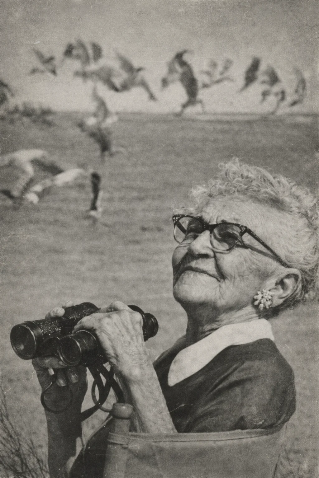
Connie Hagar at work — the woman who put Rockport on the world birding map. She moved here in 1935, made daily rounds for 35 years, and documented over 500 species. When skeptics came to challenge her records, they came, they saw, and they were convinced. She died in 1973; the guide published in her memory says: 'Rockport/Fulton still has the birds.'
 View full
Historical map of Aransas Bay showing El Copano, Fort Aranzazu at Live Oak Point, and the surrounding bay system. El Copano was the deepest natural harbor on the Texas coast — the first port in South Texas designed to supply inland missions at Refugio, Goliad, and San Antonio. Irish immigrants from County Wexford landed here in the 1830s. Spanish and Mexican vessels anchored here from 1785 until the Civil War era.
 View full
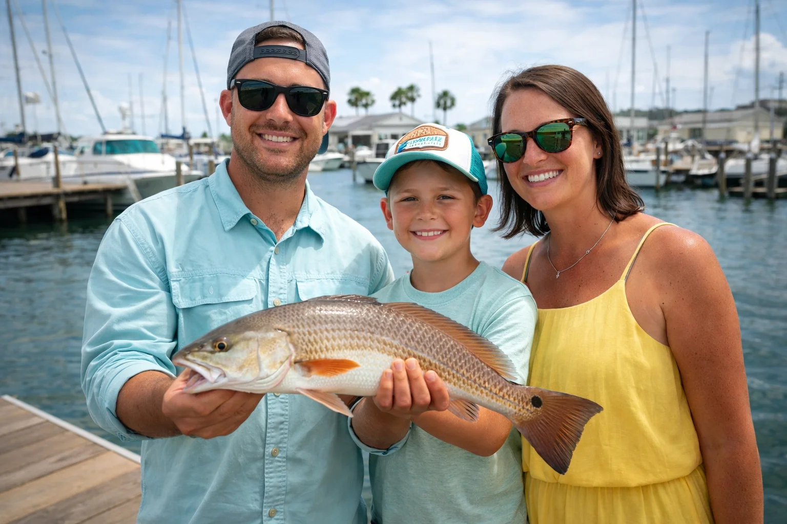
Rockport fishing, 2026. The redfish and speckled trout that Pat Williams chased from a small RV in 1952 are still in these bays. Some things don't change.
Tour Details
- Type
- birding
- Transport
- Driving Tour
- Duration
- 7h
- Distance
- 40 miles
- Difficulty
- easy
- Cost
- Free
Starting Point
The Big Tree, 1622 12th St, Rockport, TX 78382
🗺️ Part 1 Route in Google Maps🗺️ Part 2 Route in Google MapsMake a Weekend of It
Rockport has all four tours plus guided boat tours and 35 birding sites. Stay a few days and explore it all.